Mitigating Infrastructure Risk Through Collaborative Prevention
How the Hamilton to New Baltimore Groundwater Consortium used WaterSuite to address an exposed crude oil pipeline before it impacted regional drinking water.

The Challenge
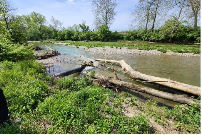
A 20-inch crude oil pipeline transporting up to 10,000 barrels per hour became exposed due to severe riverbed erosion in Southwest Ohio. With seven downstream drinking water utilities vulnerable to a potential catastrophic contamination event within less than one hour, the Consortium needed an immediate, unified response to evaluate the threat and coordinate with external stakeholders.
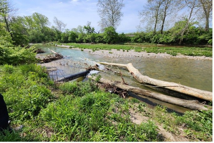
BEFORE: Exposed 10,000 bbl/hr crude pipeline in riverbed
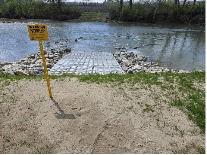
AFTER: Armored protection installed via collaborative mitigation
The WaterSuite Solution
The Consortium deployed WaterSuite to translate complex hydrogeological data into an immediate, actionable visual narrative. By mapping the exposed pipeline relative to municipal production wells and Time-of-Travel zones, WaterSuite gave stakeholders across multiple jurisdictions a clear, shared operational picture of exact risk pathways.
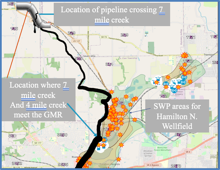
WaterSuite map integrating environmental threats with localized risk pathways to production wells.

The Outcome & Impact
Proactive Mitigation: Armed with definitive, defensible data visualizations, the Consortium successfully engaged the pipeline operator to take rapid action, installing heavy precast concrete protective armoring and stabilizing the riverbed.
Regional Risk Reduction: Prevented a potentially catastrophic contamination incident affecting seven municipal water systems serving hundreds of thousands of residents.
Inter-Agency Alignment: Transformed complex spatial data into intuitive maps that bridge technical and non-technical stakeholders, driving rapid alignment.
